http://members.aol.com/rphs44/lhhleebio.html
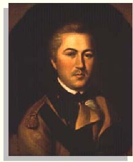
The area that now emcompasses the Buffalo was supposedly a land grant in recognition of his service during the Revolutionary War. Land speculation was a route to riches in those days, as shown by General Washington's buying and surveying great parcels of land in front of westward expansion. Light Horse Harry was not to duplicate this, as he eventually ended up in debtors prison. Local lore says that Harry's son, Carter, Robert E Lee's brother, practiced law in an old cabin still standing off Buffalo Mountain Road.
How the family managed to hold on to this property through the next generation is unknown.
Hobbyists can share and network on the Web. Heavens-above.com, for example, provides a remarkably simple guide to the galaxy, complete with local satellite-viewing times organized by magnitudes of brightness and showing precise trajectories.
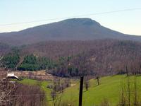
Use these coordinates for the Buffalo viewing site: 36.7960 N 80.4770 W
Amateurs contributed some of the data in a major aggregation of satellite specifics posted online last month by the Union of Concerned Scientists, according to Laura Grego, a staff scientist for the Cambridge, Mass., organization. As part of its push for public awareness of space-based government activities, the UCS (ucsusa.org/satellite_database) lists some 800 active satellites by launch date, country of origin, sponsor, and orbital coordinates. It ignores inactive satellites and other space junk.
Bid invitation with specifications published.
http://www.west-point.org/users/usma1964/25244/BidInvitation.pdf
This is non-contiguous on the north slope of the Buffalo.
http://www.west-point.org/users/usma1964/25244/KempTract.pdf
Claiborne Woodall and Bill stopped by today to get Bill introduced to the area, and to us. He's in the 20 week police academy, but should be on duty status by June. He'll be of the same genre as Al Cire, but based out of Abingdon.
Welcome to the Buffalo, Bill!
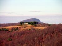
The most dramatic climb comes up the opposite slope of the Buffalo from the parking lot approach. Phillip Weddle showed me this route last summer. The road on the west side of the Buffalo comes from Burkes Fork over to Buffalo Mountain Road near our place. Best approach is 4WD from the north via Burkes Fork, where it crests the shoulder of the Buffalo. A road splits off heading toward the cleft. Here is the approach from the south by foot:
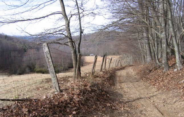
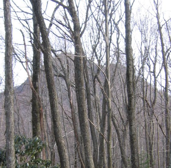
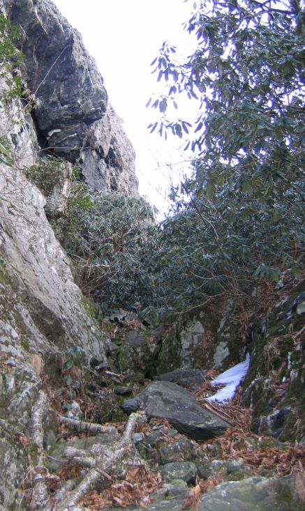
In winter, with the leaves off the trees, you can see the cleft ahead as you climb this road.
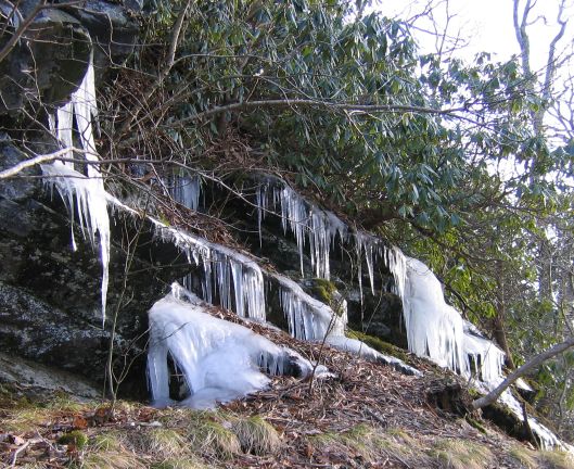
This time of year, the seeps along this face are frozen waterfalls, and ice slick rock faces. Be careful, and use both hands. Cell phones with Verizon work on this slope.
Bear to the left as you climb the shoulder, and you'll have to move into the cleft when the rhododendren starts. This is what you'll see:
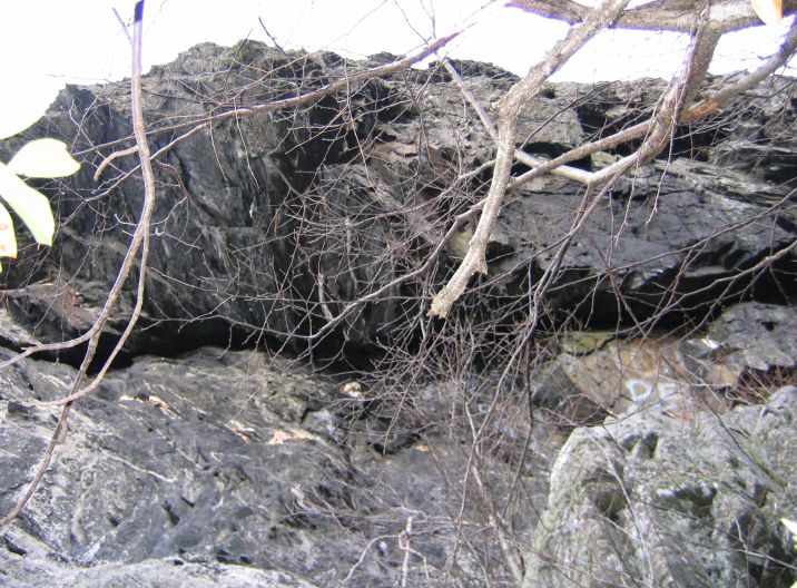
This is the overhanging left cliff with a bit of adornment.
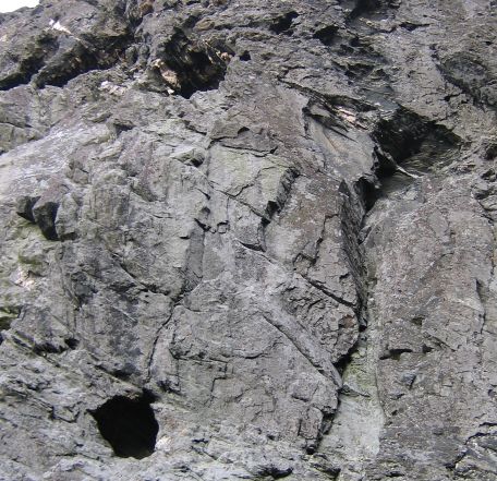
Climbing the right face of the cleft, and looking back at the opposing face, you can see the holes, small caves on that face, which locals call the kettles. Biggest opening is maybe three-four feet across. Phillip tells me there used to be a tree leaning against the cliff, granting access to the lower one, but no more. Anyone ever looked inside?
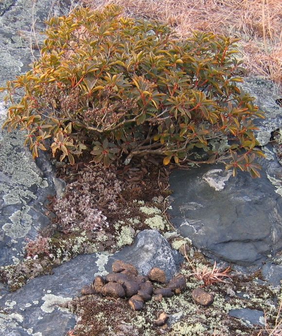
The surprise on reaching the top was this evidence a trail boss had recently ridden brought a string of horses topside. Lots of droppings! Anyone see them?
Finally, taking a look at the parking lot gate on the way down, it now has no cables and dead men. Is this a replacement? Looks old and rusty.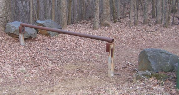
Propery owners around the Buffalo received notification from the State that aerial treatment to prevent increases in the moth population this Spring will be scheduled.
| Sun | Mon | Tue | Wed | Thu | Fri | Sat |
|---|---|---|---|---|---|---|
| 1 | 2 | 3 | 4 | 5 | ||
| 6 | 7 | 8 | 9 | 10 | 11 | 12 |
| 13 | 14 | 15 | 16 | 17 | 18 | 19 |
| 20 | 21 | 22 | 23 | 24 | 25 | 26 |
| 27 | 28 | 29 | 30 | 31 |