Home
>> Grad Info >> Directions & Maps
|
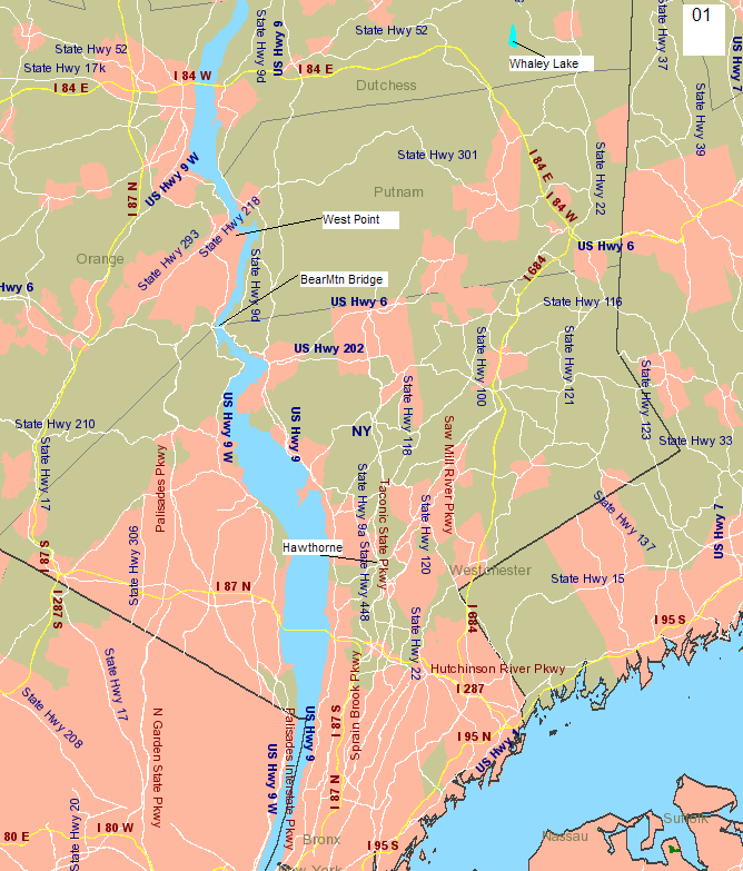
Westchester-Duchess-Orange area (Map 1) This
map shows West Point, |
|
|
|
1.
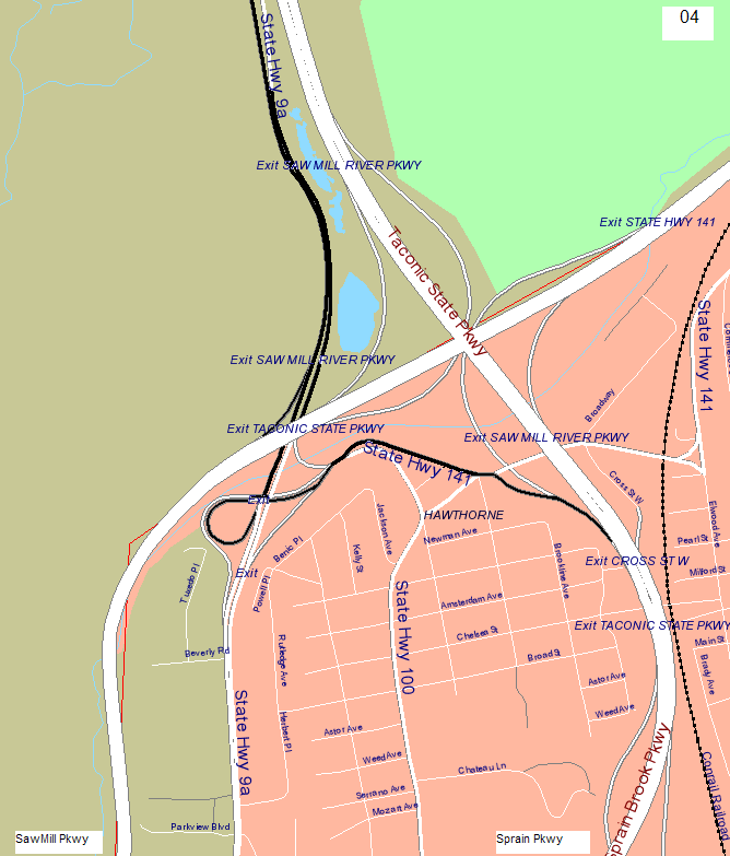
I87 Thruway & Exit
from I87 to the Saw Mill, north to |
|
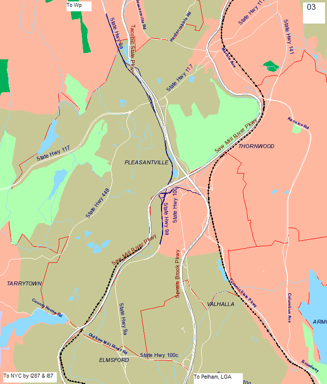
2.
Sprain & The
Sprain turns into the Taconic at |
|
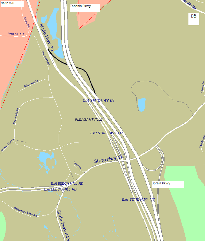
3.
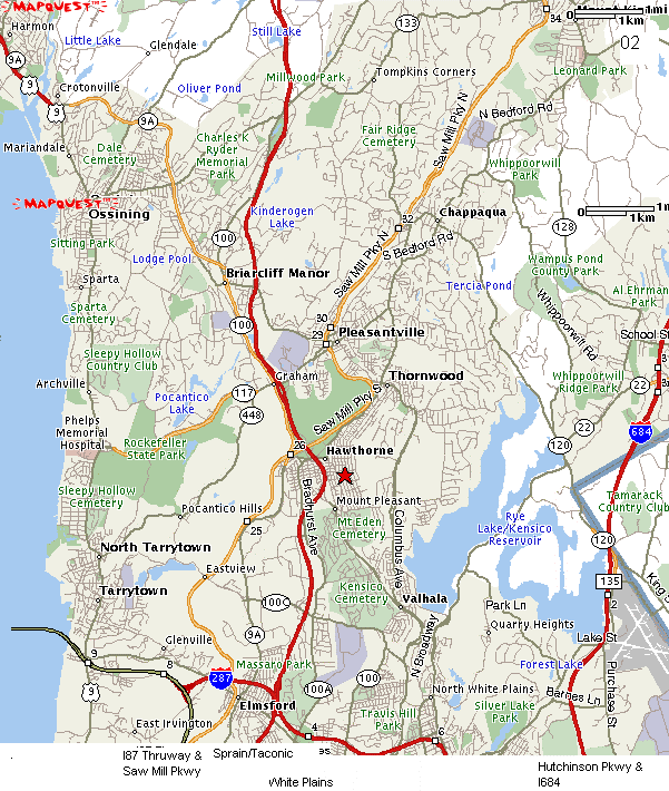
9A to Exit
to 9A (& 100) (after 117 highway exit), stay on 9A to Croton on Hudson (9
miles), stay on 9A to 9D at Peekskill (10 miles), 9D to Bear Mtn Bridge (5
miles), Bear Mtn to 9W (1 mile), north on 9W to Rt 218 (main gate 3 miles) or
Stony Lonesome exit (stadium gate 6 miles) |
|
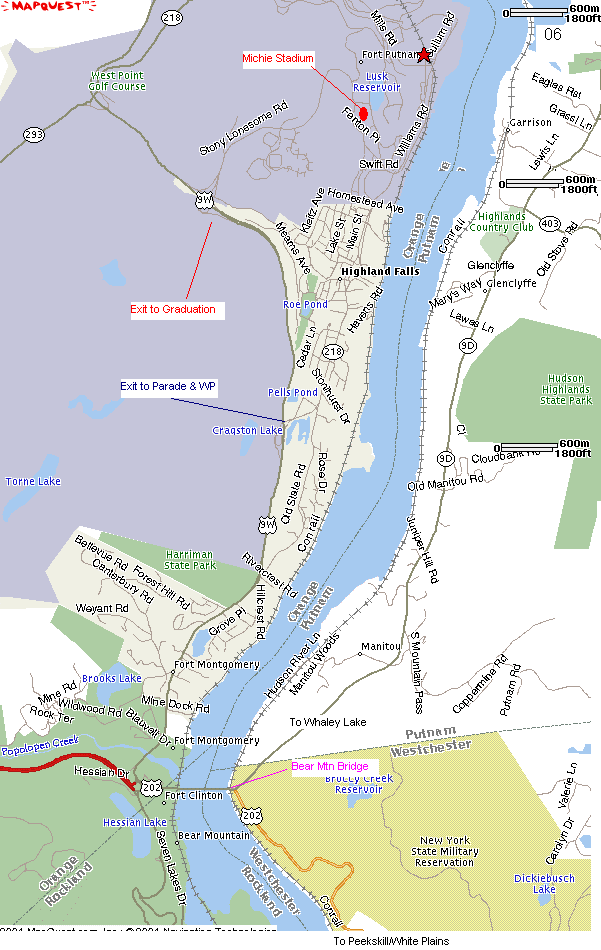
West Point to Whaley |
|
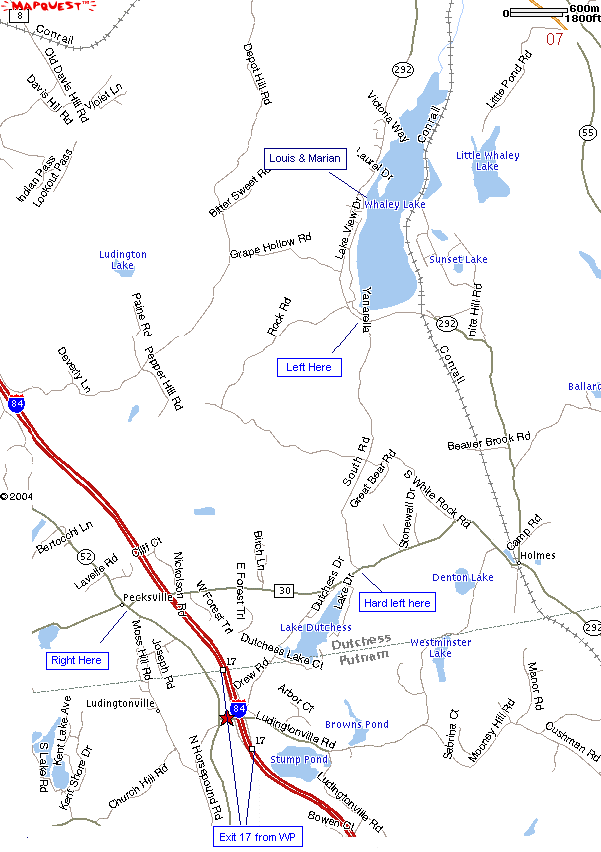
Exit
WP through Stony Lonesome (back gate), north on 9W to Newburg (11 miles), West
on I84 to Exit 17 (19 miles), Right on |
|
Back
to the Bear Mtn Bridge 9W south (6 miles), cross the bridge left on 9D (1
mile), north on 9D to Cold Spring (9 miles), right on 301 to Taconic (7
miles), continue on 301 which turns into Rt 42 (9 miles), left on 52 to
Ludingtonville Road (1) mile, see Ludingtonville Directions. |
|
North
on 52, Right on 30, Left on |